Using Laser Technology to Determine the Age of California’s Redwood Forest, the Tallest Trees on Earth
Accurately determining the size of California redwoods, which are among the tallest and oldest trees in the world, has long been a challenging endeavor. Traditional methods involved climbing the trees, making rough estimates based on trunk diameter, or resorting to cutting them down. However, these approaches have proven to be unreliable and prone to significant measurement errors.
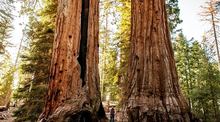
University College London and the University of Maryland have made a groundbreaking discovery by utilizing laser technology to determine the total mass of California redwoods. This innovative approach has provided scientists with unparalleled insights into the three-dimensional structure of these magnificent trees. One notable example of the trees scanned is Colonel Armstrong, standing at an impressive height of 88 meters. Located in the Armstrong Redwoods State Natural Reserve in California, USA, this colossal redwood is estimated to be more than 1400 years old.
The Crucial Role of Giant Trees in the Battle Against Climate Change
Through the use of laser technology, researchers have estimated that Colonel Armstrong, one of the California redwoods, weighs approximately 110 tonnes, equivalent to the weight of around 10 double-decker buses. This finding reveals that these majestic trees can be up to 30 percent larger than previously believed. Such insights are invaluable for scientists in determining the amount of carbon these trees absorb and how they might react to climate change. The newfound knowledge contributes to a better understanding of the vital role these giant redwoods play in mitigating climate change.
Professor Mat Disney, the lead author of the study, emphasized the significance of understanding the carbon storage capacity of different tree species in addressing important climate science inquiries. With rising CO2 levels, the need to determine the optimal locations for planting new trees and strategies for conserving existing forests becomes crucial. By comprehending the amount of carbon stored in various tree species, scientists can provide insights and informed recommendations to tackle these pressing questions effectively.
Using Space Lasers to Map Forest Carbon
NASA scientists have utilized the findings from ground-based research to enhance and evaluate a comparable technology that enables the mapping of forests from space. Through the GEDI (Global Ecosystem Dynamics Investigation) project, valuable insights into the role of trees in the global carbon cycle are being provided. Advanced laser technology installed on the International Space Station (ISS) is utilized to create intricate 3D maps of forests across the Earth. This ambitious mission released its initial dataset in January 2021, empowering environmental scientists with a deeper comprehension of how trees worldwide are sequestering and releasing carbon.